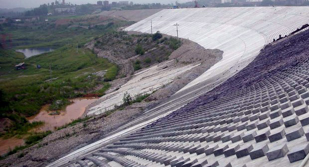
The Massive Hungarian Toxic Spill And ME – You may wonder

I put off posting about the nasty and unconscionable toxic spill in Hungary because I felt a little guilty. I said in an earlier post that I was kinda bored and having a little difficulty posting because after the Gulf Spew and Russia caught on fire talking about more down to earth topics and residential energy issues was…well…not exciting. Then I said something like we could always wish for another disaster. So then the Hungary Dam Failure happened and I was …ahhh … sheepish. But today and tomorrow we shall make amends.

http://www.peopleandplanet.net/?lid=29373&section=37&topic=23

‘Hungary must lead drive to defuse East Europe’s toxic time bombs’

Posted: 12 October 2010

As efforts continue to prevent a further spill from a toxic reservoir near the Danube, WWF has called on Hungary, as president-elect of the EU, to mount a major push to reduce the large stockpiles of poorly maintained mining wastes across eastern Europe.

The call from WWF comes as emergency operations continue to head off an increasing risk of further large scale flows of toxic aluminium processing sludge from the broken reservoir above the town of Kolontàr. The initial breach of the reservoir walls killed at least seven, inundated six villages and sent a caustic alkaline plume towards the Danube.

Toxic sludge, Hungary
Kolontar, Hungary, inundated by the tide of toxic sludge now heading down tributaries of the Danube. Photo credit: WWF Hungary

WWF has issued a photograph showing that the reservoir wall was clearly degraded and leaking more than three months before the disaster. Work has nearly finished on a secondary dyke, 1500 m long, 30 m wide and 8 m high through and alongside Kolontàr, to reduce damage from any further spills.

“The human and ecological disaster at Kolontàr – the greatest chemical disaster in Hungary’s history – has made clear the need to re-assess current regulation of such mine waste sites and begs the question how many other ticking time bombs there are in Central and Eastern Europe,” said Gabor Figeczky, interim CEO of WWF-Hungary.

Mining and mineral processing tailings dams – presumably including the Kolontàr reservoir – were listed as a priority concerns in a 2004 comprehensive study on mainly eastern European hazardous and toxic waste sites from the European Commission’s Joint Research Center.

Overall, however, environmetnal pressure groups say that information on sites,and on the risks they present, is extremely poor. WWF released a list of recent Danube releases of toxic wastes and some of the major hazard areas last week, “but it is by no means provides the kind of exhaustive analysis that is needed,” said Andreas Beckmann, Director of WWF’s Danube-Carpathian Programme.

:}

More tomorrow.

:}

The Nastiest Pollution On Earth – End this week with ickypoo

It’s Jam Band Friday – http://www.youtube.com/watch?v=lZJ-5-_f9-4

Next week I will try the cleanest places on the planet as a topic. But do not get your hopes up.

http://www.fastcompany.com/1687376/8-of-the-most-toxic-energy-projects-on-the-planet

8 of the Most Toxic Energy Projects on the Planet

BY Ariel SchwartzTue Sep 7, 2010

BP’s Deepwater Horizon disaster in the Gulf of Mexico served as a wake-up call for many of us who never before paid attention to the destructive energy projects happening all around the world. But while Deepwater Horizon may have attracted the lion’s share of media attention this past Spring and Summer, there are a number of other toxic projects still going on. Below, we look at some of the worst.

:}

http://www.youtube.com/watch?v=XjZCtMg_j04

:}

Alberta Tar Sands

Alberta, Canada is home to the second biggest recoverable oil reserve in the world: the infamous Athabasca tar sands. But the massive deposit of heavy crude oil (aka bitumen) is under a staggering 54,000 square miles of boreal forest and peat bogs, which are slowly being destroyed by the open pit mining used to recover Alberta’s oil. These open pit mining projects also deposit toxic mercury, arsenic, cadmium, and lead into the Athabasca river system, creating “masses of toxic soup.” Suncor Energy, Syncrude Canada, Shell Canada, Marathon Oil, and Chevron are all pursuing projects in the Athabasca sands.

Three Gorges Dam

China’s Three Gorges Dam, a hydroelectric dam in the Yangtze river, is world’s largest electricity-generating plant. Completed in 2006, the dam has already produced 348.4 TWh of electricity since its inception. But the Dam has its drawbacks–construction displaced 1.2 million people (not the only Chinese water project to displace huge populations), increased the risk of landslides in the area, and made nearby Shanghai significantly more vulnerable to flooding.

:}

Please read this gut wrenching article. More next week.

http://www.youtube.com/watch?v=ZZhfmBPl4Lc

:}

A Site Dedicated To The Worst Pollution On The Earth – They found their niche

The world has gotten so polluted that there is a site devoted entirely to that.

http://www.worstpolluted.org/pollution-facts-2009.html

Pollution Facts

Pollution is a Global Killer

Pollution likely affects over a billion people around the world, with millions poisoned and killed each year.  The World Heath Organization estimates that 25 percent of all deaths in the developing world are directly attributable to environmental factor.1 Some researchers estimate that exposure to pollution causes 40 percent of deaths annually.2

Pollution is Regarded as a Major (and quickly emerging) Factor in Disease

People affected by pollution problems are much more susceptible to contracting other diseases.  Others have impaired neurological development, damaged immune systems, and long-term health problems.

Women and Children are Especially at Risk, Children are Most Susceptible

Children are physiologically different and more vulnerable than adults. In some cases they have higher exposures since they eat, drink and breathe more per kilogram of body weight than adults and tend to ingest a lot more dirt and house dust than adults from their crawling around and playing outside.

While children only make up 10 percent of the world’s population, over 40 percent of the global burden of disease falls on them.  Indeed, more than three million children under age five die annually from environmental factors.

Death is Not the Only Toll of Exposure to Pollutants

Pollution causes chronic illness, neurological damage and shortened lifespan. For instance, the presence of lead in children lowers I.Q. by an estimated 4-7 points for each increase of 10 ?g/dL.3 Our database identifies populations around the globe with blood lead levels ranging from 50 -100 ?g/dL, up to 10 times the WHO reference levels for protection against neurological damage.

:}

More Tomorrow.

:}

Most Polluted Places – Apparently I could do this for a long time

Its Jam Band Friday – http://www.youtube.com/watch?v=3I1bBcda4Ko

:}

Why is that. Because the WHOLE world is polluted. Most of these places didn’t even make the last two lists.

http://www.thedailybeast.com/blogs-and-stories/2010-05-19/americas-28-most-polluted-places/

Our Most Polluted States

by The Daily Beast Info

BS Top - Polluted Sites Greenpeace marine biologist Paul Horsman shows globs of oil on a jetti at the mouth of the Mississippi River on May 17, 2010. (John Moore / Getty Images) As the EPA and BP fight over the Gulf oil spill cleanup, the Daily Beast crunches the numbers and ranks the most contaminated sites in the nation.

The BP oil rig explosion has led to untold millions in lost income for people who make their living from the Gulf, but toxic hazards are an everyday occurrence: The EPA estimates that there are 3,500 chemical spills each year, requiring $260 million to clean.

Above those, however, are the Superfund sites—places that have sustained major, long-term damage, necessitating years of cleanup. Established in 1980 after a series of toxic disasters, including the infamous Love Canal district of Niagara Falls, which turned the neighborhood into a virtual ghost town, Superfund has largely succeeded in centralizing hazardous waste cleanup and holding responsible parties financially accountable.

The BP fiasco—both a natural and human disaster—got us thinking: what are today’s most polluted toxic dumping grounds? To figure it out, we examined all available Superfund data from the Environmental Protection Agency. We filtered the results, focusing on sites that remain dangerous for human exposure and sites that have dangerous ground water. And then we ranked them using the following criteria:

· Toxicity per acre: The number of instances of each toxin, multiplied by the severity of each toxin, according to the Agency for Toxic Substances & Disease Registry, and divided by the acreage of the site.

· Toxicity per population: To determine potential human exposure we took the number of instances of each toxin, multiplied by the severity of each toxin, and divided by the population within one mile of the site. (The EPA gives a population range, and we used the higher number for this calculation.)

Since toxicity per acre is a more concrete statistic than potential human exposure (one can live near a toxic site and avoid contact), we weighted the former three times the impact of the latter. An important note: The human exposure element does not measure exposure levels, but rather indicates that the EPA believes there is a reasonable expectation that people may be exposed to contamination—exactly what the Superfund teams spend their time trying to alleviate.

:}

http://www.youtube.com/watch?v=2maAPVOZlkc&feature=fvw

:}

Acres: 2
Population: 10,000
Toxic chemicals: 34

History: From 1949 to 1991 Fletcher’s Paint Works operated a retail store and storage facility in this small New Hampshire town along the Souhegan River. In 1982 New Hampshire officials found leaking and open drums of paint chemicals in the storage area. Soil and groundwater around the site was later found contaminated with arsenic, lead, PCBs, and a slew of other nasty chemicals. The nearby Keyes Municipal Water Supply Well was shut down in the early 1980s after it was found contaminated by volatile organic compounds—gases emitted from paint and other household supplies. Cleanup began in 1988 and continues today. The EPA has tested homes in the area for gases seeping from soil into basements, with no health risks found in the homes and another round of testing due for June 2010. The main concern now is that fish in the Souhegan contain PCBs, and that the EPA has found evidence of people fishing in the river.

:}

http://www.youtube.com/watch?v=vtCJp1h45gA&feature=related

:}

#2, Haverford, Pennsylvania:
Havertown PCP

Acres: 15
Population: 50,000
Toxic chemicals: 59

History: Getting rid of toxic waste used to be so simple. National Wood Preservers, which treated wood on the site from 1947 to 1963, would take their liquid waste lined with pentachlorophenols (PCPs) to a well, and dump it down. Or they would toss the PCP-laden liquid onto the ground. A nearby stream was contaminated, though residents living within a mile of the site don’t use it for drinking water. In 1992 the EPA removed 97,000 tons of liquid waste, and 60 tons of sludge from the site. The EPA is armed with $4.2 million from the Recovery Act to finish the final cleanup phase, which includes removing contaminated soil from residential property and public spaces.

:}

There is 2. For the rest read the article. HAPPY LABOR DAY everyone. More next week.

http://www.youtube.com/watch?v=VX0cMoOiIMQ&feature=related

:}

Most Polluted Beaches In The US – Ready to take a Labor Day dip

As they say in the article, make sure it is not a dip in an open sewer. I have had this experience. It was one of the reasons I left Tampa never to return. They built their sewage ponds right next to the ocean and when there was a bad storm…it would all wash into the water. Yuck.

Dirty Dozen: The 12 Most Polluted Beaches in The U.S
Kamelia Angelova | Jul. 29, 2009, 1:15 PM |

dirty-beach-2.jpg

Careful!  The beach you’re rushing off to this weekend might actually be a sewer.

Human and animal waste, among other sewage overflow, contaminate the beachwaters of virtually every sandy retreat in the country.

See the dirtiest beaches in the country >

There were over 20,000 closing and advisory days last year at ocean, bay and Great Lake beaches because of high levels of bacteria and pollutants in the waters, according to the annual beachwater quality report – Testing The Waters – released today by the Natural Resources Defense Council (NRDC).

The agency also provides 5-star rating guide for 200 of the nation’s most popular beaches, based on beachwater quality, monitoring frequency, and public notification of contamination. Beachgoers who swim in polluted waters are at risk of contracting from various types of skin rashes and infections to meningitis and hepatitis.

Coastal cities can implement various green strategies such as green rooftops and permeable sidewalks to reduce and eliminate stromwater runoff, which overflows the sewage systems and dump polluted water in the oceans and lake.

The 12 Worst Beaches In The U.S. >

:}
I will give you the first one but you have to to the article for the other 11. If you can stand it that is.

Dirty Dozen: The 12 Most Polluted Beaches in The U.S.

1/13

Zach’s Bay at Jones Beach State Park

Zach’s Bay at Jones Beach State Park

Location: Wantagh, New YorkMajor Offenses: Tested repeatedly for high levels of bacteria in the last three years. No public advisories issued.

This popular New York beach, where boaters also often anchor, has failed many of the twice-weekly tests for the last three years. Bacteria-infested water is not the only problem here: Advisories telling you about the high levels of pollutants in the water are almost never posted online or at the beach.

:}

More Tomorrow.

:}

Are You Ready For Some Lawsuits – Gulf Coast oil spew will be in court for 25 years…

Of course I will be dead by then so I won’t care.
:}
LOUISIANA ENVIRONMENTAL ACTION NETWORK AND REPRESENTING ATTORNEY STUART SMITH CREATE WEBSITE FOR PUBLIC EXAMINATION OF ENVIRONMENTAL SAMPLING DATA IN AREAS IMPACTED BY BP CATASTROPHE
For weeks, Attorney Stuart Smith and researchers Dr. William Sawyer and Marco Kaltofen have been providing evidence contrary to the federal government’s assertions that the oil from the BP DEEPWATER HORIZON catastrophe is gone and that seafood from oil-impacted waters are not compromised.
Now, citizens can examine for themselves data compiled by Gulf Oil Disaster Recovery and the Louisiana Environmental Action Network (LEAN) at a public website maintained by Dr. Kaltofen’s company, Boston Chemical Data.
“We are thrilled about this new resource,” said Marylee Orr, Executive Director, LEAN. “This website allows anyone interested to see what chemicals were found, where they were found, and how much was found. We feel the public has the right to this information.”
The website, http://bostonchemicaldata.com/LEAN/ provides oil spill data and mapping resources. You can compare where EPA, universities and independent labs have sampled. An individual must download Google Earth in order to view the site’s various downloads and maps.
“This should be useful to environmental groups and the unified command,” said Mr. Smith. “We’ve always believed there should be more transparency in this process.”
Most recently, Mr. Smith’s team has documented a large oil plume offshore of northwest Florida which is killing seafood. Samples have been sent to Canada for independent assessment.

“As state and federal officials continue to open Gulf waters to fishing, we have to again point to evidence that the ‘all clear’ is being sounded way too early,” said Mr. Smith, who represents the United Commercial Fishermen’s Association, the Louisiana Environmental Action Network, public entities in the Gulf Coast, as well as private property and business owners. “One of the cautionary notes is that our experts have documented that toxic chemicals remain in the water and food chain – and pose a significant health risk. Those studies have shown that PAHs (polynuclear aromatic hydrocarbons) are present in shrimp from the impacted area. And the PAHs in off-shore Florida are at levels 43 times the levels of shrimp from inland, low-impact inland areas sampled in Louisiana. In our estimation, it may take eight months before the toxic soup has had substantial enough biodegradation to announce an ‘all clear’ on seafood.”
###

FOR MORE INFORMATION:
www.smithstag.com
www.gulfoildisasterrecovery.com
www.oilspillaction.com
www.leanweb.org

Dr. William Sawyer: Chief Toxicologist of Toxicology Consultants & Assessment Specialists, LLC., Sanibel, FL (Registered d/b/a 1990, Incorporated January, 1994, 2009-FL)
Marco Kaltofen, P.E.; President of Boston Chemical is a Registered Professional Engineer (Civil, Massachusetts) and an environmental scientist with more than 25 years experience in environmental, workplace and product safety investigations in North America and Eastern Europe.

CONTACT:

S. Smith: (504) 593-9600        C. Brylski/H. Harper (504) 897-6110

:}

More tomorrow

:}

President Obama And His Family Went To New Orleans – Here is what they saw

Testing Results Returning With High Levels

Report by: Wilma Subra

Results of sampling  performed by the Lower Mississippi River Keeper in the Lower Atchafalaya Bay area on August 2, 2010

Collecting oysters from Oyster Bayou
The shore of the Gulf of Mexico east of Oyster Bayou, where the Atchafalaya Bay meets the Gulf of Mexico, contained visible oil on the vegetation along the shore line.  Soil in this location contained Carbon Disulfide, 378 mg/kg Hydrocarbons and six Polynuclear Aromatic Hydrocarbons (PAHs) (0.222 mg/kg). The oiled vegetation contained 2.3% Hydrocarbons and 31 PAHs (0.554 mg/kg) that  corresponded strongly to the PAHs in the Deepwater Horizon Crude Oil spill.  Samples of Blue Crab and Fiddler Crab contained 2,230 mg/kg hydrocarbons.
Oysters sampled from a reef on Oyster Bayou in Atchafalaya Bay contained 8,815 mg/kg Hydrocarbons.

Results of sampling performed by the Lower Mississippi River Keeper in the Mississippi River Delta on August 3, 2010

Taking samples in the Mississippi River Delta
At the mouth of Pass-a-Loutre, in the reed vegetation along the shore of an island, a sediment sample was collected.   The sediment contained 71 mg/kg Hydrocarbons and 14 PAHs (0.8713 mg/kg).  The PAHs in the sample weakly support that the contaminants in the sediment are associated with the crude oil from the Deepwater Horizon.  A muscle sample collected at this location contained 6,900 mg/kg Hydrocarbons and seven PAHs (0.386 mg/kg).
A sample of oysters was collected from oysters growing on  an abandoned crab trap between Pass-a-Loutre and Redfish Bay.  The oysters contained  12,500 mg/kg (1.25%) Hydrocarbons and two PAHs (0.063 mg/kg).
Along a beach area near Redfish Bay, samples were collected from a stained area along a sandy beach area and from a vegetated area behind the beach.  The beach area had clean-up waste materials and supplies left behind by cleanup crews.  A small water body adjacent to the beach had a boom in the water and a small boat used to place the poles that secured the boom was stained with oil.  The beach area contained a number of tar balls.
The sandy soil sample contained  Carbon Disulfide, Hydrocarbons  (146 to 779 mg/kg),  and 29 to 38 PAHs (3.7259 to 3.934 mg/kg).  The PAHs support reasonable evidence that the sandy soil is contaminated with crude oil from the Deepwater Horizon.

Samples were also collected from the vegetated area (reed vegetation) behind the beach.  The vegetated area contained  oil sheens on the vegetation and on the water that collected in the sampling area.  The soil/sediment samples contained Carbon Disulfide, 2-Butanone (MEK), Toluene, 0.4 to 1.16 % Hydrocarbons, and 20 to 40 PAHs (49 to 189 mg/kg).  The PAHs in the soil/sediment strongly support that the soil/sediment is contaminated with crude oil from the Deepwater Horizon.


SaveOurGulf.orgVisit SaveOurGulf.org to get more information about the BP Deepwater Horizon disaster from Waterkeeper organizations across the Gulf Coast and donate to Save Our Gulf!

:}
Just kidding – More Tomorrow
:}

The Gulf Spill Day 400 – Oh maybe it is under 80 but it feels that way

Our latest update from LEAN. This is a group you should support.

Louisiana Environmental Action Network
&
Lower Mississippi RIVERKEEPER©

Helping to Make Louisiana Safe for Future Generations

E-ALERT
July 8, 2010
To view as a webpage – click here
The BP Oil Spill’s Toxic Effects Are Beginning To Be Seen, Scientist Frustrated By Lack Of Data
Oil/Water samples from Gulf…VERY TOXIC
Oil/Water samples from Gulf... VERY  TOXIC

This is a very compelling video from a concerned citizen who decided to take his own samples of oil found on the beach in Grand Isle, La and have them tested at a laboratory. In the water portion of the sample the lab found propylene glycol, an ingredient in Corexit 9500 and Corexit 9527A, at an estimated concentration of  430 parts per million. Propylene glycol only makes up 1-5% of the Corexit products, so, if this is indeed propylene glycol from Corexit then the concentration of Corexit as a whole is far higher.

According to EPA’s latest analysis of dispersant toxicity released in the document Comparative Toxicity of Eight Oil Dispersant Products on Two Gulf of Mexico Aquatic Test Species Corexit 9500 at a concentration of 42 parts per million killed 50% of the mysid shrimp tested and at a concentration of 130 parts per  million killed 50% of the silverside fish tested. Remember the lab found 430 parts per million of a material that makes up only 1-5% of the Corexit products.  This also does not include the toxicity of the oil itself or an oil/dispersant mix. Click the image above to go to the video or go here: http://www.youtube.com/watch?v=Gq65E7rmO_k Note: the lab technician refers to propylene glycol by one of its other names, propane-diol.

Researchers find evidence of oil spill in Gulf’s food chain

By Harlan Kirgan
Mississippi Press
June 30, 2010

Yellow oil droplets can been seen in a post-larval blue crab.
Harriet Perry, Gulf Coast Research Laboratory
Yellow oil droplets can  been seen in a post-larval blue crab.

Oil droplets have been found beneath the shells of tiny post-larval blue crabs drifting into Mississippi coastal marshes from offshore waters.

The finding represents one of the first examples of how oil from the Deepwater Horizon spill is moving into the Gulf of Mexico’s food chain. The larval crabs are eaten by all kinds of fish, from speckled trout to whale sharks, as well as by shore birds.

The tiny droplets are visible under the transparent shells of the 2-millimeter-sized crabs collected in Davis Bayou, said Harriet Perry, director for the University of Southern Mississippi Gulf Coast Research Laboratory’s Center for Fisheries Research and Development.


Spill’s extent and the effects surprising those studying it

By Lee Shearer
Athens Banner-Herald
July 07, 2010

Scientists knew weeks ago that much of the oil gushing from a blown-out oil well deep in the Gulf of Mexico remained below the surface, suspended in deep, cold water.

But research they are doing now has surprised them at the extent of the spill and effects on marine life, University of Georgia oceanographer Samantha Joye said Tuesday in UGA’s Marine Sciences Building. Joye, one of the leading scientists tracking the spill, spoke at a weekly update on her research team’s findings.

Seawater samples the team took during a June research voyage had to be diluted before analytical machines could accurately measure the oil levels in them, she said Tuesday.

Other scientists analyzing the samples still haven’t told Joye the precise concentrations of oil they’ve found in the water. But they’ve seen enough to know the levels are much higher than what was found in an earlier research cruise in May, when they measured oil contamination in parts per million or parts per billion in areas close to the spill.

The more recent water samples, many taken hundreds of feet deep in the Gulf, contain much more oil, she said.

The water samples come from in and around vast plumes of oil, methane and other chemicals mixed with sea water that have been pouring out of a broken oil well since a BP-owned drilling rig, the Deepwater Horizon, exploded April 20 and sank four days later.

Get the full article here: http://www.onlineathens.com/stories/070710/new_666367227.shtml

Gulf Oil Spill: Scientists Beg For A Chance To Take Basic Measurements

By Dan Froomkin
Huffington Post
July 6, 2010
A group of independent scientists, frustrated and dumbfounded by the continued lack of the most basic data about the 77-day-old BP oil disaster, has put together a crash project intended to definitively measure how much oil has spilled and where and how it is spreading throughout the waters of the Gulf of Mexico.

An all-star team of top oceanographers, chemists, engineers and other scientists could be ready to head out to the well site on two fully-equipped research vessels on about a week’s notice. But they need to get the go-ahead — and about $8.4 million — from BP or the federal government or both. And that does not appear imminent.

The test is designed to provide responders to future deep-sea oil catastrophes with valuable information. But, to be blunt, it would also fill an enormous gap in the response to this one.

Get the full article here: http://www.huffingtonpost.com/2010/07/06/gulf-oil-spill-scientists_n_636981.html


SaveOurGulf.orgVisit SaveOurGulf.org to get more information about the BP Deepwater Horizon disaster from Waterkeeper organizations across the Gulf Coast and donate to Save Our Gulf!

:}

Berms In The Gulf Part 2 – Bobby Jindal believes in running around like a chicken with his head cut off

See Booby Jindal and Billy “the blimp” Nungasser believe that if you run around acting like you’re in charge and “doing something” then voters will think you are an effective leader. But what the “near miss hurricane” showed is that they and their sand barriers are full of crap. Even worse, by insisting that BP hire local unemployed workers as clean up people, the tox results from previous oil spills show that they are also going to lead to people’s deaths. Way to go you two.

An Honest Discussion Of Louisiana’s Berm Plan
Part 2
Construction work in the Chandeleur Islands by Kyle Douglas Jeffery Photography: http://www.kylejeffery.ca/Main/Kyle_Douglas_Jeffery_Photography.html
Restoration Work on the Chandeleur Islands

The shut down on June 23 of part of the state’s dredging operations for construction of offshore sand berms was treated by Governor Jindal as a sudden and arbitrary action by federal agencies. (1) But the reality is somewhat different.

While some media stories conveyed the impression that the state’s entire sand berm plan was approved by the Corps of Engineers in late May, only six sections of the original proposal were given a permit. Two sections to the east of the river, on the upper end of the Chandeleur Island chain, and four sections west of the river were authorized by the Corps, which described them as “critical locations where greater immediate benefit is likely to be achieved with minimal adverse disruption of coastal circulation patterns.” (2)

The Corps Permit specified the source areas for sand/sediment: Ship Shoal, South Pelto, the Mississippi River Offshore Disposal Site, and Pass a Loutre for the western sites, and St. Bernard shoal and Hewes Point for the sites to the east. The location of borrow and dredge sites at the northern end of the Chandeleur Islands has been one of the areas of greatest concern. NOAA and other agencies had pointed out that creating borrow pits or dredging in close proximity to the islands could cause accelerated erosion and even compromise their stability, so using a source site a couple of miles away was a condition of the permit.

Soon after receiving its permit, however, the state began to voice its intention to source near to the islands after all, due to a lack of pipe for pumping sand and mud from a distance. The state said it would replace sand from the dredged site within a few weeks, but federal agencies agreed to this change with a much shorter time limit because of the possible effects on the island.

Despite the Governor’s repeated claims that “we don’t have a day to wait,” the state was not ready for the approved level of dredging even after it was approved. Federal officials said that “the state has been unprepared since the beginning, has caused further delay because it did not have the proper pipe available and has continued to asked for time to shift to the offshore site. According to the Interior Department, it gave the state permission for more than a week to use the closer source of sand while locating the pipe, but that allowing the state to continue dredging could have negative effects on existing barrier islands.” (3)

An official with the Department of Interior noted that if the department had allowed the state to continue digging where it was digging, they feared approaching a “tipping point” with an “impact on that island chain that may never be restored.”(4) The Governor’s reaction was to completely ignore these considerations and instead attack the federal agencies: “We haven’t heard from them before today about any concern about these islands or this area. All of a sudden now that we’re building new land to protect our coast, they’re worried about a hypothetical consequence?” (5)

The Governor may not have heard or read the federal agencies concerns in their response to the state’s permit application, or have seen the U.S. Geological Survey report last year about the status of the Chandeleur Islands and how they could be actually restored in ways that minimize adverse impacts (http://pubs.usgs.gov/sir/2009/5252). He could have read the comments of his own Department of Wildlife and Fisheries, which pointed out in its letter to the Corps the need to “determine whether or not borrow area excavation will increase wave energy and subsequent shoreline erosion, alter littoral currents, or otherwise impact depositional processes, in a way that undermines the sustainability of inland islands, marsh, and shorelines, most importantly the Chandeleur Islands.” (6)

For views of the sand berm and other spill related issues from the perspective of a coastal scientist  please visit the Louisiana Coast Post by Len Bahr, Ph.D. Dr. Bahr is a former LSU marine sciences faculty member who served 18 years as a coastal policy advisor to Louisiana governors from Roemer to Jindal. Dr. Bahr gives the sand berm plan an official “thumbs down” here.

(1) C. Kirkham, Times-Picayune, “Louisiana officials urge feds to let dredging continue on berm to fight Gulf oil spill,” 6/24/10, www.nola.com/news/gulf-oil-spill/index.ssf/2010/06/louisiana_officials_again_ask.html.

(2) Documents related to the plan and the state’s permit request to the Corps of Engineers have been posted at http://leanweb.org/images/stories/bpspill/emergency_permit_documents_final.pdf.

(3) C. Kirkham, J. Tilove, Times-Picayune, “State halts dredging of sand for berms,” 6/23/10.

(4) Times-Picayune, 6/24/10.

(5) Times-Picayune, 6/24/10.

(6) Louisiana Department of Wildlife & Fisheries, letter of 5/13/10, http://leanweb.org/images/stories/bpspill/emergency_permit_documents_final.pdf.


SaveOurGulf.orgVisit SaveOurGulf.org to get more information about the BP Deepwater Horizon disaster from Waterkeeper organizations across the Gulf Coast and donate to Save Our Gulf!

:}

Up Date On The Oil Gusher In The Gulf – Continue with carbon neutral houses tomorrow

When news comes in from LEAN I try to give it some play.

Louisiana Environmental Action Network
&
Lower Mississippi RIVERKEEPER©

Helping to Make Louisiana Safe for Future Generations

E-ALERT
June 22, 2010
Don’t Miss Out:
Videos of LEAN and LMRK In Action!
Check out our Executive Director, Marylee Orr, talking about protecting oil spill worker health on Countdown with Keith Olberman.

Marylee Orr, Executive Director of LEAN speaks with MSNBC’s Keith Olbermann of the health issues workers are encountering duing the cleanup efforts in the gulf
Marylee Orr on Countdown With Keith  Olberman

And don’t miss BP Oil Hits Barataria Oyster Fishing Grounds by Atchafalaya Basinkeeper, Dean Wilson and Media Guru, Jeffrey Dubinsky.

Rosie Philippie, of the near extinct Atakapa-Ishak tribe is interviewed by Atchafalaya Basinkeeper, Dean Wilson. The 10 or so families make their living on the oyster grounds in Barataria Bay, Louisiana. These ground have now been inundated with oil from the BP oil disaster.
BP Oil Hits Barataria Oyser Fishing  Grounds
click on the images to go to the videos

SaveOurGulf.orgVisit SaveOurGulf.org to get more information about the BP Deepwater Horizon disaster from Waterkeeper organizations across the Gulf Coast and donate to Save Our Gulf!

:}

More Tomorrow

:}