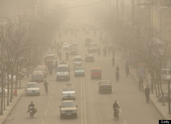
Most Polluted Places – Apparently I could do this for a long time

Its Jam Band Friday – http://www.youtube.com/watch?v=3I1bBcda4Ko

:}

Why is that. Because the WHOLE world is polluted. Most of these places didn’t even make the last two lists.

http://www.thedailybeast.com/blogs-and-stories/2010-05-19/americas-28-most-polluted-places/

Our Most Polluted States

by The Daily Beast Info

BS Top - Polluted Sites Greenpeace marine biologist Paul Horsman shows globs of oil on a jetti at the mouth of the Mississippi River on May 17, 2010. (John Moore / Getty Images) As the EPA and BP fight over the Gulf oil spill cleanup, the Daily Beast crunches the numbers and ranks the most contaminated sites in the nation.

The BP oil rig explosion has led to untold millions in lost income for people who make their living from the Gulf, but toxic hazards are an everyday occurrence: The EPA estimates that there are 3,500 chemical spills each year, requiring $260 million to clean.

Above those, however, are the Superfund sites—places that have sustained major, long-term damage, necessitating years of cleanup. Established in 1980 after a series of toxic disasters, including the infamous Love Canal district of Niagara Falls, which turned the neighborhood into a virtual ghost town, Superfund has largely succeeded in centralizing hazardous waste cleanup and holding responsible parties financially accountable.

The BP fiasco—both a natural and human disaster—got us thinking: what are today’s most polluted toxic dumping grounds? To figure it out, we examined all available Superfund data from the Environmental Protection Agency. We filtered the results, focusing on sites that remain dangerous for human exposure and sites that have dangerous ground water. And then we ranked them using the following criteria:

· Toxicity per acre: The number of instances of each toxin, multiplied by the severity of each toxin, according to the Agency for Toxic Substances & Disease Registry, and divided by the acreage of the site.

· Toxicity per population: To determine potential human exposure we took the number of instances of each toxin, multiplied by the severity of each toxin, and divided by the population within one mile of the site. (The EPA gives a population range, and we used the higher number for this calculation.)

Since toxicity per acre is a more concrete statistic than potential human exposure (one can live near a toxic site and avoid contact), we weighted the former three times the impact of the latter. An important note: The human exposure element does not measure exposure levels, but rather indicates that the EPA believes there is a reasonable expectation that people may be exposed to contamination—exactly what the Superfund teams spend their time trying to alleviate.

:}

http://www.youtube.com/watch?v=2maAPVOZlkc&feature=fvw

:}

Acres: 2
Population: 10,000
Toxic chemicals: 34

History: From 1949 to 1991 Fletcher’s Paint Works operated a retail store and storage facility in this small New Hampshire town along the Souhegan River. In 1982 New Hampshire officials found leaking and open drums of paint chemicals in the storage area. Soil and groundwater around the site was later found contaminated with arsenic, lead, PCBs, and a slew of other nasty chemicals. The nearby Keyes Municipal Water Supply Well was shut down in the early 1980s after it was found contaminated by volatile organic compounds—gases emitted from paint and other household supplies. Cleanup began in 1988 and continues today. The EPA has tested homes in the area for gases seeping from soil into basements, with no health risks found in the homes and another round of testing due for June 2010. The main concern now is that fish in the Souhegan contain PCBs, and that the EPA has found evidence of people fishing in the river.

:}

http://www.youtube.com/watch?v=vtCJp1h45gA&feature=related

:}

#2, Haverford, Pennsylvania:
Havertown PCP

Acres: 15
Population: 50,000
Toxic chemicals: 59

History: Getting rid of toxic waste used to be so simple. National Wood Preservers, which treated wood on the site from 1947 to 1963, would take their liquid waste lined with pentachlorophenols (PCPs) to a well, and dump it down. Or they would toss the PCP-laden liquid onto the ground. A nearby stream was contaminated, though residents living within a mile of the site don’t use it for drinking water. In 1992 the EPA removed 97,000 tons of liquid waste, and 60 tons of sludge from the site. The EPA is armed with $4.2 million from the Recovery Act to finish the final cleanup phase, which includes removing contaminated soil from residential property and public spaces.

:}

There is 2. For the rest read the article. HAPPY LABOR DAY everyone. More next week.

http://www.youtube.com/watch?v=VX0cMoOiIMQ&feature=related

:}

Most Polluted Beaches In The US – Ready to take a Labor Day dip

As they say in the article, make sure it is not a dip in an open sewer. I have had this experience. It was one of the reasons I left Tampa never to return. They built their sewage ponds right next to the ocean and when there was a bad storm…it would all wash into the water. Yuck.

Dirty Dozen: The 12 Most Polluted Beaches in The U.S
Kamelia Angelova | Jul. 29, 2009, 1:15 PM |

dirty-beach-2.jpg

Careful!  The beach you’re rushing off to this weekend might actually be a sewer.

Human and animal waste, among other sewage overflow, contaminate the beachwaters of virtually every sandy retreat in the country.

See the dirtiest beaches in the country >

There were over 20,000 closing and advisory days last year at ocean, bay and Great Lake beaches because of high levels of bacteria and pollutants in the waters, according to the annual beachwater quality report – Testing The Waters – released today by the Natural Resources Defense Council (NRDC).

The agency also provides 5-star rating guide for 200 of the nation’s most popular beaches, based on beachwater quality, monitoring frequency, and public notification of contamination. Beachgoers who swim in polluted waters are at risk of contracting from various types of skin rashes and infections to meningitis and hepatitis.

Coastal cities can implement various green strategies such as green rooftops and permeable sidewalks to reduce and eliminate stromwater runoff, which overflows the sewage systems and dump polluted water in the oceans and lake.

The 12 Worst Beaches In The U.S. >

:}
I will give you the first one but you have to to the article for the other 11. If you can stand it that is.

Dirty Dozen: The 12 Most Polluted Beaches in The U.S.

1/13

Zach’s Bay at Jones Beach State Park

Zach’s Bay at Jones Beach State Park

Location: Wantagh, New YorkMajor Offenses: Tested repeatedly for high levels of bacteria in the last three years. No public advisories issued.

This popular New York beach, where boaters also often anchor, has failed many of the twice-weekly tests for the last three years. Bacteria-infested water is not the only problem here: Advisories telling you about the high levels of pollutants in the water are almost never posted online or at the beach.

:}

More Tomorrow.

:}

The Most Polluted Places On Earth – This from the Huffinton Post

I am not sure if I agree with the list below, but if you can only pick 9 when there are that many in the Old Soviet Union alone. Well then:

http://www.huffingtonpost.com/2010/08/31/photos-most-polluted-plac_n_693008.html

9 Of The Most Polluted Places In The World (PHOTOS)

Huffington Post |  Barbara Fenig First Posted: 08-31-10 08:26 AM   |   Updated: 09- 1-10 01:55 AM

81

From the highways of Los Angeles to the Citarum River of Bandung, Indonesia, earth’s most polluted city of Linfen, China to the streets of London, the world is laden with man-made pollution. Chemical, air, water and oil pollution ruin the environment, cause premature deaths, spoil the world’s resources and worsen climate change.

As the world’s population soars to nearly 7 billion, we here at HuffPost Green decided to take a virtual tour of some of the world’s most polluted places. Check out our slideshow of nine of the most polluted places in the world. Find out which city’s death rate surpasses its birth rate by 260 percent. Or which city has 50,000 people die prematurely each year due to man-made air pollution. As always, we want to hear from you. Tell us what you think in the comments.

Linfen, China
1 of 10

Linfen, China is the most polluted city on earth. According to Mother Nature Network, if one puts laundry out to dry, it will turn black before finishing drying. Located in China’s coal belt, spending one day in Linfen is equivalent to smoking three packs of cigarettes. 3 million people are affected by Linfen‘s coal and particulates pollution, which is residue from automobile and industrial emission

:}

Only one of nine. Please go see the rest. More tomorrow

:}

Are You Ready For Some Lawsuits – Gulf Coast oil spew will be in court for 25 years…

Of course I will be dead by then so I won’t care.
:}
LOUISIANA ENVIRONMENTAL ACTION NETWORK AND REPRESENTING ATTORNEY STUART SMITH CREATE WEBSITE FOR PUBLIC EXAMINATION OF ENVIRONMENTAL SAMPLING DATA IN AREAS IMPACTED BY BP CATASTROPHE
For weeks, Attorney Stuart Smith and researchers Dr. William Sawyer and Marco Kaltofen have been providing evidence contrary to the federal government’s assertions that the oil from the BP DEEPWATER HORIZON catastrophe is gone and that seafood from oil-impacted waters are not compromised.
Now, citizens can examine for themselves data compiled by Gulf Oil Disaster Recovery and the Louisiana Environmental Action Network (LEAN) at a public website maintained by Dr. Kaltofen’s company, Boston Chemical Data.
“We are thrilled about this new resource,” said Marylee Orr, Executive Director, LEAN. “This website allows anyone interested to see what chemicals were found, where they were found, and how much was found. We feel the public has the right to this information.”
The website, http://bostonchemicaldata.com/LEAN/ provides oil spill data and mapping resources. You can compare where EPA, universities and independent labs have sampled. An individual must download Google Earth in order to view the site’s various downloads and maps.
“This should be useful to environmental groups and the unified command,” said Mr. Smith. “We’ve always believed there should be more transparency in this process.”
Most recently, Mr. Smith’s team has documented a large oil plume offshore of northwest Florida which is killing seafood. Samples have been sent to Canada for independent assessment.

“As state and federal officials continue to open Gulf waters to fishing, we have to again point to evidence that the ‘all clear’ is being sounded way too early,” said Mr. Smith, who represents the United Commercial Fishermen’s Association, the Louisiana Environmental Action Network, public entities in the Gulf Coast, as well as private property and business owners. “One of the cautionary notes is that our experts have documented that toxic chemicals remain in the water and food chain – and pose a significant health risk. Those studies have shown that PAHs (polynuclear aromatic hydrocarbons) are present in shrimp from the impacted area. And the PAHs in off-shore Florida are at levels 43 times the levels of shrimp from inland, low-impact inland areas sampled in Louisiana. In our estimation, it may take eight months before the toxic soup has had substantial enough biodegradation to announce an ‘all clear’ on seafood.”
###

FOR MORE INFORMATION:
www.smithstag.com
www.gulfoildisasterrecovery.com
www.oilspillaction.com
www.leanweb.org

Dr. William Sawyer: Chief Toxicologist of Toxicology Consultants & Assessment Specialists, LLC., Sanibel, FL (Registered d/b/a 1990, Incorporated January, 1994, 2009-FL)
Marco Kaltofen, P.E.; President of Boston Chemical is a Registered Professional Engineer (Civil, Massachusetts) and an environmental scientist with more than 25 years experience in environmental, workplace and product safety investigations in North America and Eastern Europe.

CONTACT:

S. Smith: (504) 593-9600        C. Brylski/H. Harper (504) 897-6110

:}

More tomorrow

:}

President Obama And His Family Went To New Orleans – Here is what they saw

Testing Results Returning With High Levels

Report by: Wilma Subra

Results of sampling  performed by the Lower Mississippi River Keeper in the Lower Atchafalaya Bay area on August 2, 2010

Collecting oysters from Oyster Bayou
The shore of the Gulf of Mexico east of Oyster Bayou, where the Atchafalaya Bay meets the Gulf of Mexico, contained visible oil on the vegetation along the shore line.  Soil in this location contained Carbon Disulfide, 378 mg/kg Hydrocarbons and six Polynuclear Aromatic Hydrocarbons (PAHs) (0.222 mg/kg). The oiled vegetation contained 2.3% Hydrocarbons and 31 PAHs (0.554 mg/kg) that  corresponded strongly to the PAHs in the Deepwater Horizon Crude Oil spill.  Samples of Blue Crab and Fiddler Crab contained 2,230 mg/kg hydrocarbons.
Oysters sampled from a reef on Oyster Bayou in Atchafalaya Bay contained 8,815 mg/kg Hydrocarbons.

Results of sampling performed by the Lower Mississippi River Keeper in the Mississippi River Delta on August 3, 2010

Taking samples in the Mississippi River Delta
At the mouth of Pass-a-Loutre, in the reed vegetation along the shore of an island, a sediment sample was collected.   The sediment contained 71 mg/kg Hydrocarbons and 14 PAHs (0.8713 mg/kg).  The PAHs in the sample weakly support that the contaminants in the sediment are associated with the crude oil from the Deepwater Horizon.  A muscle sample collected at this location contained 6,900 mg/kg Hydrocarbons and seven PAHs (0.386 mg/kg).
A sample of oysters was collected from oysters growing on  an abandoned crab trap between Pass-a-Loutre and Redfish Bay.  The oysters contained  12,500 mg/kg (1.25%) Hydrocarbons and two PAHs (0.063 mg/kg).
Along a beach area near Redfish Bay, samples were collected from a stained area along a sandy beach area and from a vegetated area behind the beach.  The beach area had clean-up waste materials and supplies left behind by cleanup crews.  A small water body adjacent to the beach had a boom in the water and a small boat used to place the poles that secured the boom was stained with oil.  The beach area contained a number of tar balls.
The sandy soil sample contained  Carbon Disulfide, Hydrocarbons  (146 to 779 mg/kg),  and 29 to 38 PAHs (3.7259 to 3.934 mg/kg).  The PAHs support reasonable evidence that the sandy soil is contaminated with crude oil from the Deepwater Horizon.

Samples were also collected from the vegetated area (reed vegetation) behind the beach.  The vegetated area contained  oil sheens on the vegetation and on the water that collected in the sampling area.  The soil/sediment samples contained Carbon Disulfide, 2-Butanone (MEK), Toluene, 0.4 to 1.16 % Hydrocarbons, and 20 to 40 PAHs (49 to 189 mg/kg).  The PAHs in the soil/sediment strongly support that the soil/sediment is contaminated with crude oil from the Deepwater Horizon.


SaveOurGulf.orgVisit SaveOurGulf.org to get more information about the BP Deepwater Horizon disaster from Waterkeeper organizations across the Gulf Coast and donate to Save Our Gulf!

:}
Just kidding – More Tomorrow
:}

Gulf Of Mexico Gusher – It kills some big stuff but it is the little stuff that matters

While there should be some worry about big stuff like dolphins, pelicans and shrimp, the stuff to worry about is the small stuff, the worms, planktons, and snails. The bottom of the food chain next year is what the real worry should be. Once they are killed off, the top of food chain dies off too.

:}

Sampling For BP Contamination In The Mississippi River Delta

LEAN and Lower Mississippi Riverkeeper have begun a sampling project in collaboration with the six other Save Our Gulf Waterkeepers. The sampling project will cover the Gulf Coast from Galveston Bay in Texas to Apalachicola Bay in Florida.

Sampling In The Delta

The sampling project will look for the presence of the components of crude oil and dispersant in the environment and what happens to them over time. Click the picture above to watch a short video of a recent sampling trip or go here: http://www.youtube.com/watch?v=e5q25IPi3QA


SaveOurGulf.org

Visit SaveOurGulf.org to get more information about the BP Deepwater Horizon disaster from Waterkeeper organizations across the Gulf Coast and donate to Save Our Gulf!

:}

More tomorrow

:}

Gulf Gusher Is Plugged – President vacations on the Gulf Coast

Everything is fine. No news is old news. Emergency over. Forgetaboutit. The modern news cycle and the short term memory public moves on. We need our gas. We need all our unnecessary  commercial STUFF and we need to get back to school. So what if 10 percent of the nation is unemployed by the corporate capitalists. So what if Russia just burned and Pakistan just drowned. This in from LEAN.

Don’t forget: If there is oil out there we must find it.

:}

http://www.flickr.com/photos/lowermississippiriverkeeper/sets/72157624713485348/

BP Disaster Continues to Wreak Death and Destruction

LEAN member and New Orleans photographer Jerry Moran revisited Raccoon Island on August 8, 2010 to find more of the same death and destruction that he found on his visit on July 18, 2010.

A Dead Pelican On Raccoon Island August 8, 2010
A Dead Pelican On Raccoon Island

Of his July 18, 2010 trip to Raccoon Island Jerry wrote:

“death is everywhere and I mean everywhere, even though visible oil is much less an issue, which concerns me greatly. A lot of the birds that weren’t dead, were obviously poisoned, almost acting drunk and dazed. Some were hardly walking, and some were alive, but lying where they will surely expire, some were actually fighting each other for food(surely contaminated)…….It is really hard for me to believe that nothing can be done to curb what is no less than the extermination of our beloved state bird, along with thousands of other birds and animals. There are not many times where I have just stopped shooting and left….yesterday was one of those day’s.”
A Dead Red Fish On Raccoon Island August 8, 2010
A Dead Red Fish On Raccoon Island

Of his August 8, 2010 trip to Raccoon Island Jerry wrote:

“The difference this time was that there were not as many (living) birds…… probably at least 60% less but just as much death if not more. Pelicans, Seagulls, Bull Redfish, Drum….you name it it was dead on the beach.  Oil had hit Raccoon Island last week and the island was obviously manicured, BP had set up tents on the 2 adjoining Islands.  All of the boom that was on the island and on top the jetties was gone, and the island was flat where it once had a more natural terrain….two of the pelicans had died very recently, and it was most disturbing that one of them was hooked to a sparkle beatle (a kind of fishing lure) which was tangled in dead mangrove…….I have no doubt that either Wildlife and Fisheries or BP workers had to have seen this Pelican while alive and just left him there to die.  A lot of the dead birds stomach cavaties were open and a brown sludge covered the inside, with the scent of oil.”
A Dead Juvenile Bird On Raccoon Island August 8, 2010
A Dead Juvenile Tern On Raccoon Island August 8, 2010


SaveOurGulf.org

Visit SaveOurGulf.org to get more information about the BP Deepwater Horizon disaster from Waterkeeper organizations across the Gulf Coast and donate to Save Our Gulf!

:}

The Face Of Global Warming – World food shortages and fires

It is jam band Friday – http://www.youtube.com/watch?v=DD2zkvE_uQg

Well it has started. The SUN came back on and the nearly 3 year solar “quiet” has ended. The next 11 years could be some of the most fascinating and horrific witnessed since WWII, WWI, or the Civil War here in America. I am not jumping for joy or anything but we are going to get closer to the Sun at the same time and our tip towards the Sun…what we call summer is going to “tip” a little more, so it will probably get hot pretty fast. This isn’t bad for a warm up so to speak…But if you want to close your eyes and pretend it isn’t happening you can’t do better then Kelly Clarkson.

:}

http://www.youtube.com/watch?v=h4sJMcgeDe0&feature=related

:}

http://www.theage.com.au/world/russia-bans-grain-exports-as-drought-consumes-crops-20100806-11ohl.html

Russia bans grain exports as drought consumes crops

ANDREW KRAMER, MOSCOW

August 7, 2010

Heatwave, drought and now the wildfires, like this one in the western region of Ryazan, are the worst in Russia's modern history. <i>Picture: AFP</i>Heatwave, drought and now the wildfires, like this one in the western region of Ryazan, are the worst in Russia’s modern history. Picture: AFP

RUSSIAN Prime Minister Vladimir Putin has banned all exports of grain after millions of hectares of wheat have withered in a severe drought, driving up prices around the world.

Russia is suffering the worst heatwave since record-keeping began here, more than 130 years ago.

”We need to prevent a rise in domestic food prices, we need to preserve the number of cattle and build up reserves for next year,” Mr Putin said in a meeting broadcast on television. ”As the saying goes: reserves don’t make your pocket heavy.”

:}

Must take a music break.

http://www.youtube.com/watch?v=JQ7FWZcwotM:}

:}

The abrupt ban – earlier this week, a deputy agricultural minister had said no such measure would be taken – shows Mr Putin retains the right to marshal state power in defence of Russian interests.

Russia’s emergencies minister has warned that the wildfires raging in the west of the country could release radioactive particles from land contaminated by the Chernobyl nuclear disaster.

Sergei Shoygu said laboratories were monitoring a potential release of contaminants in Bryansk region, on the border with Ukraine. The region was sprayed with caesium-137 and strontium-90 after the Chernobyl explosion in 1986.

”In the event of a fire there, radionuclides could rise together with combustion particles, and a new zone of pollution will appear,” he said.

The wheat export ban is widely seen as a move to address rising resentment over the heatwave and the fires.

:}

Go to the article to read the rest. I can’t go on. More next week.

http://www.youtube.com/watch?v=svxP2LjBg_4:}

:}

BP Thinks It Is Time To Scale Back – Tip toe tip toe tip toe

UPDATE FROM THE GULF FROM LEAN

Where has all the BP oil gone?

The question, ‘where has all the oil gone?’ has been answered in the media in recent days by scientists providing much speculation about how the oil may go away but little hard data about what is actually happening in the Gulf. We cannot let the future of the Gulf rest on speculation.

The danger of this conjecture is that people are already beginning to tune out and assume that everything is fine, even within the spill response.

So, where is the oil?

Oil in grass between Oyster Bayou and Taylor’s Bayou, St. Mary’s Parish, Louisiana, July 30, 2010, Photo Credit: Antonia Juhasz. Oil in grass, St. Mary’s Parish, La, July 30, 2010, by Antonia Juhasz.

The BP oil can be found on the shores of St. Mary Parish. Just yesterday, July 30, 2010, stretches of shoreline along St. Mary Parish were found that were significantly oiled. This area was believed to be safe from the spill and was not given any attention by Unified Command. Even the St. Mary Parish President thought that they would not receive oil. (1)

Oil South end of Oyster Bayou, St. Mary’s Parish, Louisiana, July 30, 2010, Photo Credit: Antonia Juhasz. Oyster Bayou, St. Mary’s Parish, La, July 30, 2010, Photo by Antonia Juhasz

The BP oil can be found under the shells of post-larval blue crabs all across the northern Gulf of Mexico. As reported in a previous E-ALERT, researchers in Mississippi had found post-larval blue crabs with oil under their shells. Now the researchers have given another update on their findings and it is sobering. Nearly all of the crab larvae that the researchers have collected to date, from Grand Isle, LA to Pensacola, FL, have BP’s oil under their shells, but it doesn’t stop there. Chemical analysis suggests that the crabs may also contain the Corexit dispersants used on the spilled oil. Only time will tell if this contamination will affect commercial harvests but equally troubling is the potential for toxic materials to make their way into the food chain as these tiny crabs are important food sources for a host of other sea creatures. (2)

Yellow oil droplets can been seen under the shell of a post-larval blue crab. Yellow oil droplets can been seen in a post-larval blue crab.

Scientists saying that the effects of the BP oil spill will be minimal are speculating from very little data. It may make the media happy and the news more interesting but it is not good science to speculate on the outcome of the oil spill studies before they are even well underway.

The BP oil can also be found in “plumes” of dispersed oil floating around deep under the surface of the Gulf of Mexico. Researchers at the University of South Florida have confirmed that these “plumes” are, in fact, clouds of BP’s oil. (3)

Because of the massive use of dispersants, which conveniently shield the impacts from view, the real damage is much harder to quantify. The dispersal of the oil has caused an unknown, but undoubtedly very large, portion of the spilled oil to be mixed into and spread all through the Gulf waters in tiny little bits.

The damages caused by this sub-surface oil may not be apparent for some time. Like the crabs; the juvenile forms of fish, shrimp and many other species as well as the plankton they feed on will be exposed to the toxicity of the oil and the dispersants.

Imagine your city filled with smoke from a large fire. Now replace the air with water and the smoke with tiny droplets of dispersed oil and you have a better sense of how the ‘plumes’ of oil are impacting sea creatures.

That damage is difficult to quantify but to dismiss it as minimal is irresponsible. Many commercial and sport species in one of the most biologically productive areas of the world are being exposed to a mixture of materials that are known to be toxic and we really don’t know what the effects will be.

It is too early to be speculating about the impacts of the millions of barrels of BP oil on Louisiana and the Gulf of Mexico. It is especially problematic when its done by scientists in the media. We need to be focused on figuring out what actually is going on in the Gulf with thorough research and sound data.

The real answer to the question is this: significant amounts of the oil are still out in the Gulf environs and we really don’t know what the long term effects will be.

1. Antonia Juhasz, “BP’s “Missing Oil” Washes Up in St. Mary’s Parish, LA,” The Huffington Post 30 July 2010, .

2. Dan Froomkin, “Scientists Find Evidence That Oil And Dispersant Mix Is Making Its Way Into The Foodchain,” The Huffington Post 29 July 2010, .

3. Sara Kennedy, “Researchers confirm subsea Gulf oil plumes are from BP well,” McClatchy Newspapers 23 July 2010,

:}
More tomorrow.
:}

People Toss HydroCarbons Around Like There Is No Tomorrow

It is both true and disgusting. When you think nothing could get more cruel or stupid, these things happen…:

http://www.telegraph.co.uk/finance/newsbysector/energy/oilandgas/7913940/New-oil-spill-in-the-Gulf-of-Mexico-after-tug-boat-strikes-well.html

New oil spill in the Gulf of Mexico after tug boat strikes well

A new oil spill in the Gulf of Mexico has created a mile-long slick after a tug boat struck an abandoned well off the Louisiana coast.

By Heidi Blake
Published: 9:20AM BST 28 Jul 2010

A crew was scrambled from the Deepwater Horizon clean-up operation after the collision sent a plume of oil and gas 100ft into the air.

The spill in Barataria Bay, which is surrounded by wildlife-rich wetlands, is at least the third leak since in the area since the BP oil catastrophe began on April 10.

The area of ocean 65 miles south of New Orleans would normally be occupied by fishermen, shrimpers and oystermen, but it has been deserted since the BP spill began.

The abandoned wellhead burst in the early hours of Tuesday morning after being hit by a tug boat that was pushing a dredge barge.

About 6,000 feet of boom was placed around the spill, and the Coast Guard was surveying the scene from a helicopter.

Admiral Thad Allen, the US Coast Guard chief, said the oil platform was surrounded by a sheen and a vapour that was probably a combination of oil and gas spewing from the well.

:}

From one end of the country to the other:

http://michiganmessenger.com/40133/michigan-oil-spill-a-replay-of-gulf-spill

Michigan oil spill a replay of Gulf spill?

By Ed Brayton 7/27/10 3:28 PM

It’s looking like the oil spill from a pipeline into the Talmadge Creek in Calhoun County is going to be a replay of the BP oil spill in the Gulf of Mexico in at least one respect — the companies, aided by the government, do not want the media to have access to take pictures and video of what is going on. The Michigan Messenger’s Todd Heywood is on the scene and was turned away from one of the primary sites by employees of Enbridge, the company that owns and operates the pipeline.

Heywood was at 12 Mile Rd. and C Avenue at a bridge over the Ceresco Dam when employees from Enbridge turned him away. The employee would only give his name as Mike, and when he noticed Heywood writing down the information he said, “I’m not telling you anything else” and walked away.

A sheriff’s deputy on the scene confirmed that he was not allowed to take pictures there of the oil spill or the wildlife. He then went to the Enbridge command center and was told by Enbridge spokesperson Lorraine Grymala that he would have to go to the Calhoun County Sheriff to talk to them about it.

:}

More tomorrow

(I mean at this rate I really hope there isn’t…but I am sure there will be>)

:}